Key takeaways:
- High pressure building in the region will allow for temperatures to continue to warm and dry conditions to prevail.
- National Weather Service is urging residents to take extra precautions during this period of extreme heat and dryness.
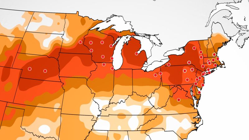
- Summerlike heat will continue to build across the Midwest and Northeast through Friday, as temperatures soar to as much as 30 degrees above normal.
A sudden onset of warm weather this month has brought a pattern of red flag warnings across large sections of the United States. The National Weather Service has issued red flag warnings for the Twin Cities and southern Minnesota on Thursday.
The high pressure building in the region will allow for temperatures to continue to warm and dry conditions to prevail. Nearly 90 daily records could be broken on Thursday and Friday, mainly across the Midwest and Northeast, and at least 50 record-high minimum temperatures could be set.
On Wednesday, Sioux Falls, South Dakota, hit 92 degrees, shattering its old record of 85 set in 1908. Twin Cities, Minnesota, also broke a record after reaching a high of 88 degrees.
The National Weather Service is urging residents to take extra precautions during this period of extreme heat and dryness. They are advising people to avoid activities that could spark a fire, such as mowing dry grass or using fireworks. They also recommend that people stay hydrated and limit outdoor activities during the hottest parts of the day.
The summerlike heat will continue to build across the Midwest and Northeast through Friday, as temperatures soar to as much as 30 degrees above normal. Residents are advised to stay informed of the latest weather forecasts and take the necessary precautions to stay safe.


Be First to Comment